

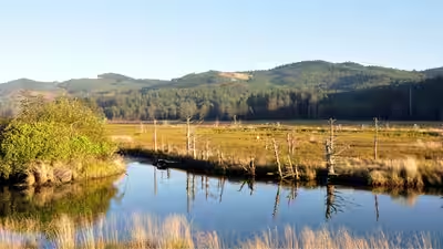

Oregon’s Siletz Bay is restoring 37 acres of tidal wetland this summer, digging new channels where more than a century of diking turned marsh into pasture
Oregon’s Siletz Bay is undergoing a major wetland restoration effort this summer, with crews working to bring back natural tidal flows to land that was dramatically altered by more than a century of diking and land conversion. According to the U.S. Fish and Wildlife Service, the project is restoring 37 acres of wetlands in the Drift Creek Unit of Siletz Bay National Wildlife Refuge, including by filling old drainage ditches and digging new tidal channels. The work is intended to improve habitat, water quality and flood resilience while creating better conditions for fish and other wildlife.
How the wetlands changed
The lower Drift Creek floodplain was once a complex coastal landscape made up of tidal marshes, scrub-shrub areas, spruce swamps and winding channels that carried water toward Siletz Bay. Over time, however, people changed the landscape through diking and land conversion.The dikes restricted the movement of tides, while drainage and other alterations transformed large portions of the historic wetlands into pasture. Natural channels gradually filled with sediment, leaving the floodplain far less connected to the tidal system than it had been in the past.The loss of these natural connections also affected the floodplain’s ecological functions. Tidal wetlands provide habitat for fish and wildlife and help move water and nutrients through coastal ecosystems. The current restoration project is designed to reverse some of those changes by reconnecting historic floodplain surfaces and allowing tidal processes to return.
New channels reshape the landscape
Through the end of August, heavy equipment including excavators and trucks will be working across the 37-acre restoration area. Crews are filling old linear drainage ditches and excavating new tidal channels designed to resemble the pathways that once carried water through the floodplain. The project also involves placing large pieces of wood in the landscape. These structures can provide shelter for young fish while eventually becoming part of the wetland’s natural habitat structure. Crews are also regrading low areas so different parts of the floodplain can reconnect with one another.The work is expected to change how water moves through the site. Instead of being confined by old drainage systems and dikes, water will be able to spread across the restored floodplain. This will help reduce flooding while allowing wetlands to perform their natural functions.The restoration is also expected to help filter sediment and nutrients from upstream flows, contributing to better water quality. For fish that depend on estuarine environments, the changes can create safer areas for movement and additional feeding habitat. Young coho and Chinook salmon, steelhead and cutthroat trout are among the fish expected to benefit, along with smaller marine species that use the estuary for shelter.
From construction to a living wetland
The restoration will not end when the excavators leave. Once the heavy construction work is completed, the landscape will continue changing as tides, rainfall, plants and wildlife begin interacting with the newly created channels and floodplain. By fall, crews plan to plant and seed native wetland species. These will include sedges, rushes, salt-tolerant plants and coastal spruce. Over time, the vegetation is expected to help rebuild the structure of the marsh and provide additional habitat.The project is part of a larger, multi-year restoration effort rather than an isolated construction project. A first phase was completed in 2023, restoring 41 acres of former tidal wetlands east of Drift Creek Road. That phase included lowering old dikes, creating more than a mile of new tidal channels, installing large wood structures, building habitat mounds and removing aging infrastructure. Since then, native marsh and scrub-shrub vegetation has begun returning, while rare spruce swamp habitat has also started to regenerate.Several organisations are involved in the broader effort, including the MidCoast Watersheds Council, the U.S. Fish and Wildlife Service’s Oregon Coast National Wildlife Refuge Complex, Oregon Department of Fish and Wildlife, Bureau of Land Management, Wild Salmon Center, Lincoln Soil and Water Conservation District, Wolf Water Resources and the Confederated Tribes of Siletz Indians.The goal is ultimately to allow the floodplain to function more like a natural tidal wetland again. As the new channels fill with water and native vegetation takes root, the landscape will gradually become more capable of supporting fish, wildlife and plants while helping manage water and improve coastal ecosystem health.For people travelling along U.S. Highway 101 near the refuge, the site will initially be marked by excavators and restoration crews. Once the machinery leaves, the restored landscape will continue developing with the seasons and tides.